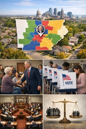
What a State Legislative District Is
State legislative districts are the building blocks of representation in state government. Each district elects a person to a state house or state senate, and those lawmakers write laws that affect daily life, from schools to transportation to taxes. The idea is simple: people in the same area share a representative who is expected to understand local needs.
Purpose: Turning Residents Into Constituents
A district connects a group of residents to a specific lawmaker, giving people a clear point of contact for help with state issues and a clear person to hold accountable at election time. Without districts, it would be harder to know who represents you, and harder for representatives to focus on the problems of particular places.
Districts also create a manageable system for elections. Instead of running statewide campaigns for every legislative seat, candidates compete in smaller areas where voters can compare them more directly. In theory, that keeps representation closer to the ground and helps local priorities show up in lawmaking.
Population Balance and “One Person, One Vote”
Population balance is the underlying concept behind modern districting. There is an implicit understanding that every vote should carry roughly the same weight, hence the shaping of districts with populations that match as closely as possible. When one has fewer people than another, voters in that smaller constituency essentially get more of an advantage.
"Equal" will not ever in implementation signify "exactly the same." Some states permit small deviations, particularly in devising districts for state senatorial elections, as the differences are kept legitimate and not only employed for disenfranchising instance. It is when population balance gets misused to entrench power that courts may be brought in, and performance criteria must be applied in order to guarantee that votes are not being diluted away.
Boundaries: Geography, Communities, and Practical Lines
District boundaries are not drawn in a vacuum. Mapmakers work with real landscapes, local government borders, and communities that do not always fit neatly into one shape. A district must be understandable enough that people can identify with it and functional enough that elections and representation run smoothly.
Natural and Human-Made Features
Geographic features often become natural district edges because they are stable and familiar. Rivers, mountains, and coastlines can separate communities in ways that match daily life, especially where travel is difficult or where settlement patterns cluster around certain corridors.
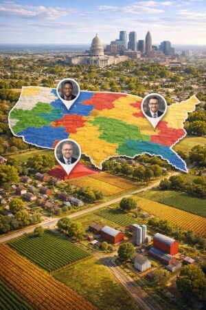
How Districts Are Drawn and Redrawn
District maps are not permanent. They typically change after the national census, which happens every ten years, because population shifts can leave old districts uneven. Who draws the maps varies by state: sometimes the legislature does it, sometimes an independent or bipartisan commission is responsible, and sometimes a hybrid process is used.
Even when the process is run carefully, redistricting is a high-stakes exercise because small line changes can reshape political outcomes for a decade. That is why many states build in procedural safeguards, public transparency steps, and legal checks meant to protect voters and reduce conflicts of interest.
- New census data is released and analyzed to see where populations grew or shrank.
- Draft maps are created using required criteria like equal population, contiguity, and compliance with voting rights protections.
- Public input may be collected through hearings, written comments, or community-submitted maps.
- The map is approved through the state’s designated process (legislative vote, commission approval, or both).
- Legal review and potential court challenges can follow if the map is alleged to violate constitutional or statutory rules.
- Final maps are implemented for upcoming election cycles, with election officials updating precinct assignments and voter information.
Rules and Legal Standards That Shape Maps
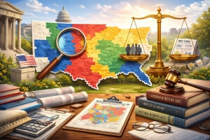
Redistricting is political, but it is not anything-goes. Legal standards exist to keep districts within certain boundaries of fairness and to protect groups from having their voting strength intentionally weakened. These rules come from federal constitutional principles, federal statutes, and each state’s own constitution and laws.
At the federal level, equal protection principles support the idea that districts should be roughly equal in population and not designed to unfairly disadvantage voters. Courts have long treated severe population imbalances as a serious problem because they distort representation.
Why Representation Is Geographic
Why is the system based on place at all? In other words, why is geographical representation set forth as the prime cause in the system of legislation? Why is the space fixed in relationship to democratic process? Issues cross across cities; there is no limit to location, hygiene services, and overall intersections between modern life and space. Democrats share a degree of these common bonds in regard to farmer aptitude, breaking-out driver codes, facility development approvals, public schools, etc.-in every single city.
In the early days, for the first time, American representation arose in the world of distances and locally connected communities. Territory or land, roads, ports, agriculture, development, right of ownership, and these and varying other involved in local activities were associated with a definitive location and called for representatives linked to that location.
This setup still holds true today-even as states' territories expanded. The arrangement of regional differences with regional focus and distinct economic priorities and disparities within urban/rural interests was the chief goal of each state legislature. The system has evolved more in favor of population equity so that a simplistic reputation and relevance is allocated to the aforementioned agenda while maintaining the geographic system.
What Districts Mean for Voters
For most people, districting becomes real in simple questions: Who is my state representative? Why is my neighbor in a different district? Why did my polling place change? District lines influence these everyday details, and they also influence the long-term responsiveness of government.
A clear district makes it easier to hold a lawmaker responsible for results. If you know who represents you, you know who to contact about a broken state road, an unemployment system issue, or a school funding concern. That line of responsibility is one of the main democratic benefits of district-based representation.
The Real-World Bottom Line: A Map That Decides Who Speaks for You
Districts are a civic design choice with real consequences: they determine who represents you, how equal your vote is compared with others, and whether communities can advocate effectively. Because these choices can be abused, redistricting is surrounded by legal standards, oversight mechanisms, and public participation opportunities intended to protect voters.
If you remember one thing, it is this: representation is not only about candidates and elections. It is also about the boundaries that decide which voters are counted together, and whether the system is meeting its basic promise of fair and compliant representation.
Washington has released their four draft congressional maps pic.twitter.com/KsQ04D4xZG
— Lillian Belle (@LillianBelle2) September 28, 2021